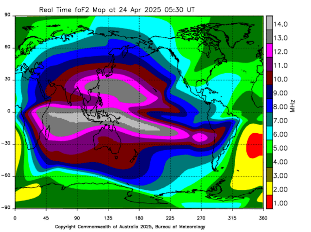
Map produced by Australian Space Weather Forcast Centre.
The white circle is centered on the Hawaiian Islands.
The image updates every 15 minutes.
Colors represent the highest frequency reflected by the F2 Layer.
Hold down [Control] key to move the magnifier.
Move magnifier to the right side of this image if it is hard to read.
Click the (AU F2 Map) button (below) to recenter the magnifier.